“The magic of yesterday can seem downright ordinary to the wizards of today” -Papa Gravy
History & Basics of GNSS
In surveying many acronyms are thrown around again and again, and for newcomers this can be aggravating to say the least. Lets cover the basics, what is what?
- GPS - Global Positioning System
- GNSS - Global Navigation Satellite System
- RTK - Real-Time Kinematic
- RTCM - Radio Technical Commission for Maritime Services
- NTRIP - Network Transport of RTCM via IP
- CORS - Continuously Operating Reference Stations
Phew, that’s a lot of technical jargon! Lets explore how these items helps us get more accurate surveying information.
GPS is a part of GNSS. GPS refers the Department of Defense’s constellation of satellites, while GNSS refers to all satellites overhead. Systems like GPS, Galileo, GLONASS, & BeiDou are operated by different countries. When you use a GNSS receiver in the field it is speaking to all available satellites in an effort to achieve the highest level of accuracy. How does this work? Triangles, atomic clocks, and a bit of actual witchcraft. As a surveyor right triangles are your best friend. Being able to have an extremely precise relationship between 3 points based on the degrees angling towards each other is key to calculating distances. Satellites use this concept and a copious amount of mathematical & observed adjustments to calculate the position of a GNSS receiver on the ground (or anywhere else).
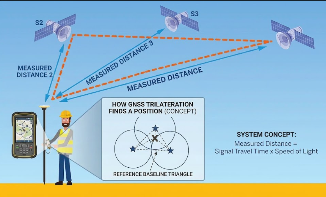
GNSS & How it Gets Better GNSS is great for vast distances and for achieving accuracy within a few feet, but surveyors need higher accuracy to achieve legally required tolerances. This is where critical tools like base stations, NTRIP corrections, and CORS networks become our bestest friends. A base station is a known point that is sending out a signal to help a receiver triangulate its own position. Because a base station is typically much closer than a satellite in space, we get tighter tolerances than would otherwise be possible. A base can be a simple transmitter with a radio antenna on it, a receiver functioning as a base, or a point on a large permanent structure that has been created using advanced calculations and long term observations.
The longer you stay on a point, typically the more accurate it becomes. As more and more observations from satellites pile up on one another, it brings our tolerances down dramatically. 1 second, 30 second, up to 2 hours if you’re setting up a long-term control point, these observations all serve different purposes. Once you have a point you want to use, you’ll set your base up. An easy way to accomplish this is change a receiver/rover to base mode. Set it up over the point with a tripod or bipod, and set it to transmit. boom Now you have a base that you can connect to using your receiver. Typically you’ll have a mile range before you lose signal, this can be increased using a larger antenna or a more powerful frequency transmitter.
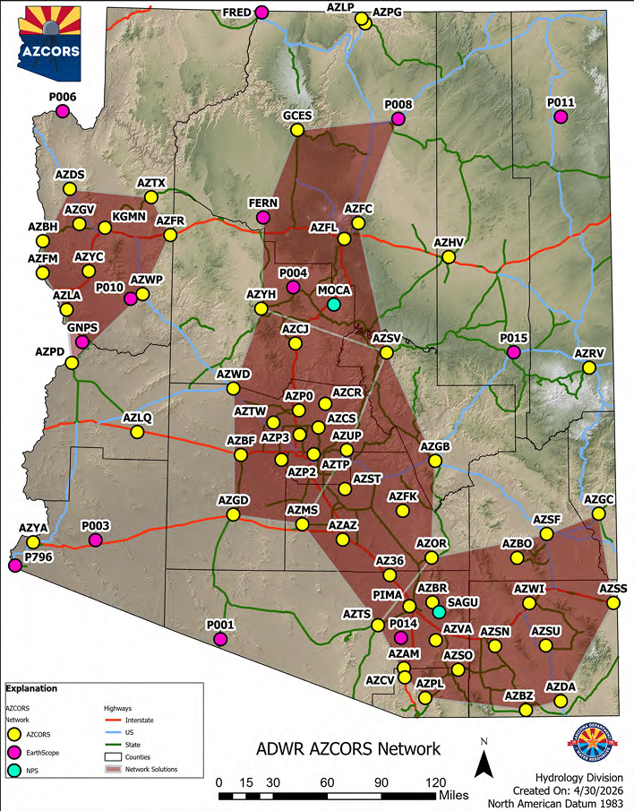
In many parts of the state of Arizona in the U.S.A., there is an NTRIP network called AZCORS. This network is run by Arizona’s water departments and is free for all to use after setting up an account. NTRIP (Network Transport of RTCM via IP) connects via the internet using the ports on your device. Arizona’s water departments run around the state and set up sites that send adjusted coordinates via wireless signal to devices logged into an account. The more sites the greater coverage and the better results we as surveyors enjoy. When I work in the field within 20,000ft of a tower I can achieve tolerances as low as 0.03ift. For reference that is about the thickness of a standard credit card 🤯